

ROS: Reading GPS Data
This function reads GPS module data through the terminal and parses the GPS data to obtain latitude, longitude, and altitude data.
1. Reading GPS Data Through the Terminal
In the terminal, enter,
ros2 launch nmea_navsat_driver nmea_serial_driver.launch.py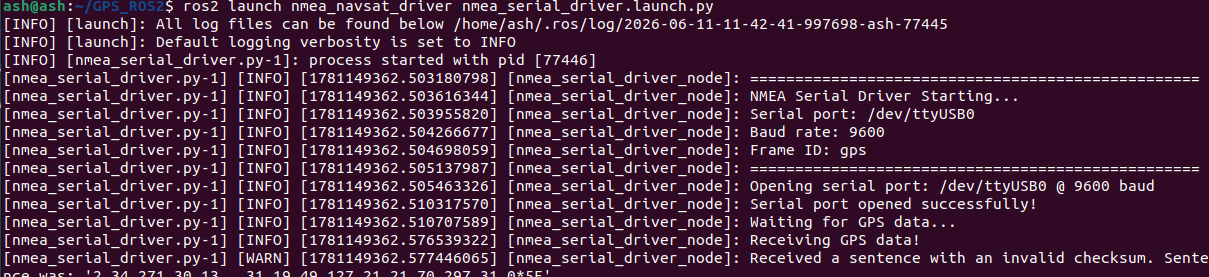
Then let's check the topic data. In the terminal, enter,
ros2 topic list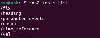
Here is a description of the data of these GPS topics,
| Topic | Type | Description |
|---|---|---|
| /extend_fix | gps_common/GPSFix | The GPSFix message contains the GPS satellite status and positioning information |
| /fix | sensor_msgs/NavSatFix | GPS positioning information |
| /time_reference | sensor_msgs/TimeReferencd | GPS time information |
| /vel | geometry_msgs/TwistStamped | GPS speed information |
For the message types of each topic, refer to the official website URLs below,
sensor_msgs/NavSatFix Documentation (ros.org)
sensor_msgs/TimeReference Documentation (ros.org)
geometry_msgs/TwistStamped Documentation (ros.org)
We can print these topic messages in the terminal, and what we get is the GPS data. Taking printing /fix as an example, enter in the terminal
ros2 topic echo /fixThe terminal will print the following data,
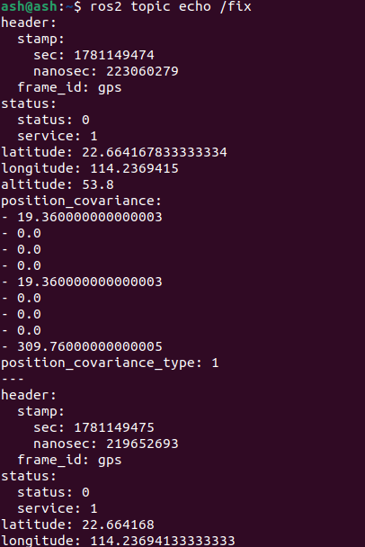
Here, latitude, longitude, and altitude represent the latitude, longitude, and altitude respectively.
2. Reading the Latitude, Longitude, and Altitude of the GPS Data
Run in the terminal,
ros2 launch nmea_navsat_driver nmea_serial_driver.launch.pyIn another terminal, run,
ros2 run nmea_navsat_driver read_lat_long.py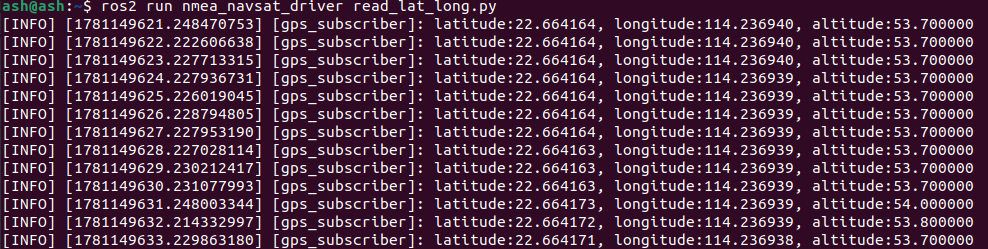
The data printed in the terminal is the current latitude, longitude, and altitude of the GPS module. Let's look at the source code, read_lat_long.py
#! /usr/bin/env python3
# -*- coding: utf-8 -*-
import rclpy
from rclpy.node import Node
from sensor_msgs.msg import NavSatFix

class GPSSubscriber(Node):
    def __init__(self):
        super().__init__('GPS_subscriber')
        self.subscription = self.create_subscription(
            NavSatFix,
            '/fix',
            self.gps_callback,
            10)
        self.subscription

    def gps_callback(self, msg):
        self.get_logger().info(f"latitude:{msg.latitude:.6f}, longitude:{msg.longitude:.6f}, altitude:{msg.altitude:.6f}")

def main(args=None):
    rclpy.init(args=args)
    gps_subscriber = GPSSubscriber()
    rclpy.spin(gps_subscriber)
    gps_subscriber.destroy_node()
    rclpy.shutdown()

if __name__ == '__main__':
    main()
The program subscribes to the data of the /fix topic, then performs parsing in the callback function, and finally prints to the terminal.